

These settings let you fine‑tune your alerts, so you only receive notifications that are useful to you.
When you first set up your alerts, we recommend leaving these settings at their default values. Adjust them only after you have received your first few notifications.
When to stop alerting me
Unless you chose new or uncommon weeds as your alert type, you will receive notifications for all species included in your alert. This applies no matter how many records exist, or how old they are.
You can refine this by limiting the number of weed records and the age of weed records for each species:
- Limit by number of records. The 'stop alerting me after n records' setting restricts alerts to species with fewer records than you specify. Note that this applies to each species on its own. It does not include records of lower-rank taxa (e.g. subspecies) in the count.
- Limit by age of records. Older weed records are often added to GBIF. For example, this happens when historical specimens are digitised or newly identified. The 'only count records from the past n years' setting filters out older records so you only receive alerts for more recent detections.
These two settings work together. As records age, they fall outside the time window you set. That reduces the total count for each species and can change whether it meets your record‑limit threshold.
If you chose 'New or uncommon weeds', you can change the defaults here. You can set the maximum number of records and how old they can be.
Maximum location uncertainty
Each weed record may have a location uncertainty value. This describes how accurate the recorded location is. The uncertainty may come from the recording device (for example, the GPS accuracy). It may be set by the person who recorded the weed. Or a publisher may add it on purpose to hide the exact location. You can choose how much location uncertainty is acceptable and filter records to match.
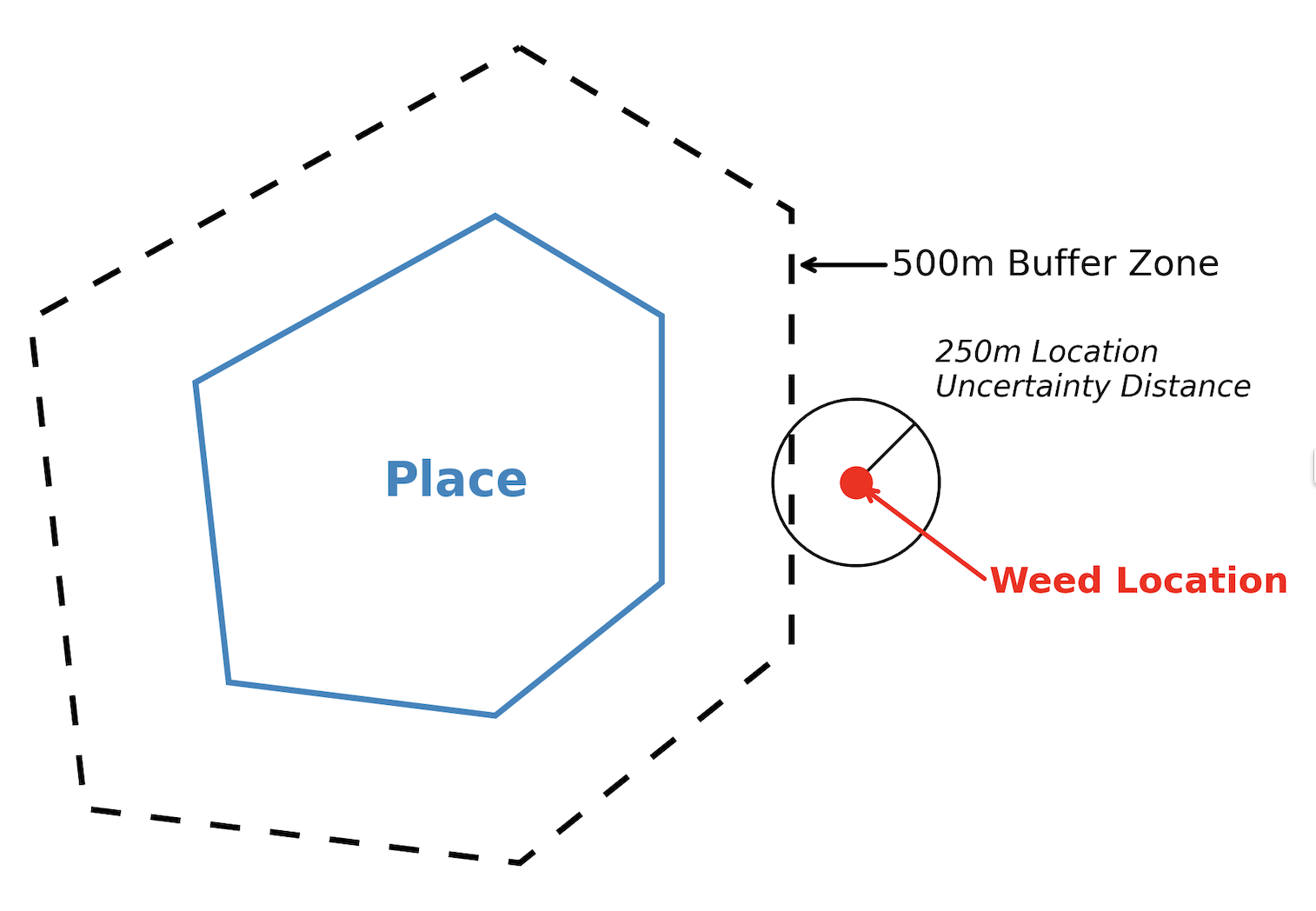
The location uncertainty area is shown as a circle centred on the weed record. The radius equals the location uncertainty value attached to the record. If the record has no location uncertainty value, it is shown as a point at the recorded location.
You will receive an alert if a weed record's location overlaps your selected place. This includes the record's uncertainty radius and the place's buffer zone. For example, a weed record outside your place and buffer may still trigger an alert if its uncertainty radius extends into the buffer zone. Here is an example:
Be aware that some data sources include very large uncertainty values. For instance, iNaturalist records with obscured locations are assigned a location uncertainty of around 28 km. Some historical records have uncertainties of 2,000 km, and a small number exceed 15,000 km.
The default setting for maximum location uncertainty is 25 m, except for regions and 'All of New Zealand'. You can adjust all default values in the 'Advanced settings' section of the alert form.
Exclude species
You may want to exclude certain species from your alert. For example:
- you have selected a whole genus, but do not want notifications about particular species in that genus. For example, you want notifications for all species in the genus Asparagus, except for Asparagus scandens because it's already widespread in your area. The same applies to higher‑level groups. For example, you can create an alert for an entire family but exclude a particular genus.
- you have selected a category, such as a Regional Pest Management Plan (RPMP), but want to ignore particular species in that category. For example, your selected RPMP includes gorse, but you do not want to receive alerts about new gorse records.
To exclude a species, start typing a few characters of the common name or scientific name. Select the '+ Exclude' button next to the species you want to exclude from your alert.
After you fine‑tune your advanced settings, you can review your alert.